Traveling through Chile - Navigation
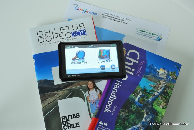
We used a combination of print and digital maps along with our Footprints Handbook as we prepared for and traveled throughout Chile. The Footpints Handbook and Google Maps were handy for our pre-trip planning and we then relied on our COPEC map booklet and MAPEAR maps loaded on our Garmin Nuvi to navigate the highways and streets once we arrived.
Footprints Handbook

We picked up a copy of Footprints Handbook for Chile prior to our trip to give us ideas on the best places to visit. As we prepared for our trip, we found the 'Essentials' section very helpful. We chose to use a rental car to get around the country based on this section and its discussion on road travel, in addition to the fact that there were three of us traveling together, we had a moderate amount of luggage to stow, and my six foot six inch body wouldn’t easily fit into a bus outfitted for shorter Chileans. We learned about insurance and safety requirements as well as what to expect when we refilled the car with fuel. The handbook does a great job of breaking the country down by regions/areas/cities and providing reliable information on shopping, dining, historical, and event information for each.
The author goes beyond the basics and provides the reader with a glimpse of their surroundings not normally apparent to the casual traveler. We found this information very helpful as we traveled from town to town as it provided background to the customs, traditions, and folklore. As we traveled to the Archipelago of Chiloe, we read of the Pincoya mermaid, the Caleuche ghost ship, and El Trauco and when we arrived we had a better understanding of area's uniqueness.
COPEC Map of Chile

We picked this gem up at a COPEC fuel station in Valparaiso after spending a couple of hours trying to gain our bearings. The 85 page booklet provides detailed regional maps, city maps, and a distance table. The regional maps provided enough detail in the highway systems to plan travel routes between towns. The city and municipal maps were detailed enough to assist with general navigation in the moderately-sized towns we visited, but was not enough to navigate the winding streets of Valparaiso and often didn’t contain any information on towns with populations less than 75,000.
MAPEAR (Mapas Electrónicos Argentinos)
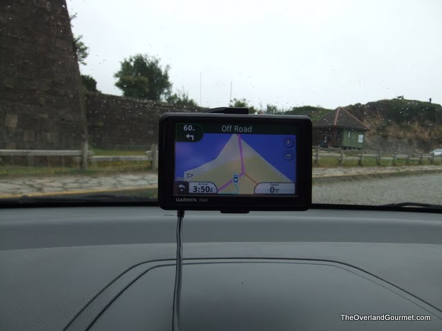
We loaded the maps of Chile from Proyecto MAPEAR onto our Garmin Nuvi 1390LMT prior to our departure to Chile. Proyecto Mapear is a free mapset for Garmin products and provides detailed highway and road maps for Argentina, Uruguay, Chile, and Paraguay. The detail in these maps is not as high as the Garmin maps we have used for North American and Europe and on occasion we were forced to rely on our COPEC map and our own intuition to navigate. Unlike those of us in the United States, most Chilean drivers do not travel with GPS units. The demand for highly detailed maps is not very high, and this low demand results in maps with limited functions. We immediately discovered the limitations to the maps when we first arrived in Chile, but thanks to some quick thinking and some helpful locals we were able to navigate throughout the country without incident!
Although the Proyecto MAPEAR maps may not be as detailed as those we are used to when traveling in North American and Europe, we would still suggest loading them on your Garmin when traveling in Chile. We feel these maps will improve overtime and provide additional information in the coming years.
Overall, we would suggest using as many navigation resources as are available to you. There were many trips where we used the COPEC map to get from city to city, the Proyecto software on the Nuvi to get around town, and Google Maps to find neighborhood streets or streets without street signs. See our Valparaíso post to get a picture of some navigation difficulties you may encounter if not properly prepared.
___________________________
 Krista Johnston is the Co-Founder and Editor in Chief of Living Overland. Krista is an avid outdoor enthusiast who enjoys exploring National Parks, fly fishing, and hiking with her husband (Beau) and their two dogs.
Author
Krista Johnston is the Co-Founder and Editor in Chief of Living Overland. Krista is an avid outdoor enthusiast who enjoys exploring National Parks, fly fishing, and hiking with her husband (Beau) and their two dogs.
___________________________
If you found this article helpful, please consider using one of the affiliate links below. The price is the same for you, but a small percentage of the purchase price goes to us, which helps keep this site going. Thank you!